Our Services
Using an unmanned aircraft (commonly known as a”drone”) we are able to undertake a range of aerial photography tasks, including:
- Site surveys
- GPS fixed point photography
- Orthophoto and 3D model generation
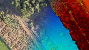
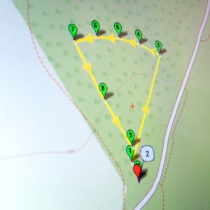
Our Unmanned Aerial Vehicle (UAV) is equipped with a camera capable of producing high-definition video or high-resolution still photographs. At the heart of the aircraft is a sophisticated autopilot system, which can be programmed to accurately follow a pre-planned survey path – a path that can be repeated days, months or years later, allowing you to track changes in land use or vegetation growth.
Post-flight we can offer a wide range of editing services, so whether you are looking for a single image or a complete video production we can deliver what you need.
We hold a Civil Aviation Authority “Permission for Commercial Operation”, a legal requirement for anyone flying a UAV for commercial purposes in the United Kingdom, and are covered by £5,000,000 of public liability insurance for aerial work.